Tour of Points East Coastal Drive
Prince Edward Island
Tour of Points East Coastal Drive
Prince Edward Island
Let Karen tell you the story
 This is a driving tour we enjoyed in an easy afternoon. The day was sunny, and we left the Bayside RV Campground and using an old-fashioned map we followed the roads and highways that looked like they led to interesting places.
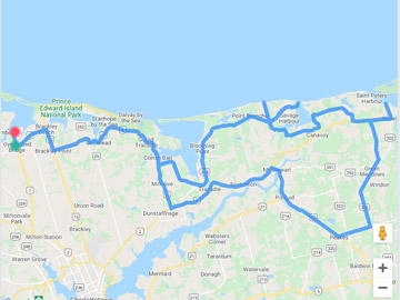
The roads we took are in the map and also the map is in the slideshow.
 Coming out of the campground we followed Rt #6 and turning away from Brackley Beach entrance followed Rt #15, getting back on Rt #6 at Brackley Point. Just past Corran Ban we turned onto Rt #219 to cut across to Rt #218 which took us to the shore.
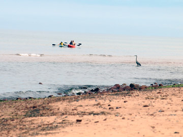
Where Rt #217 intersects, we turned left to follow a dirt road which took us to our first stop, a beautiful beach surrounded by dunes. A short way down the road we got out of the car, followed the sandy pathway through the small dunes and came out onto a sandy beach. We watched a heron fly as the kayaks came too close. Chessey and Sadie enjoyed the swim and playing stick.
 We retraced our steps to the next small adventure, continuing along Rt #218 (Savage Harbour Rd.) we passed Savage Harbour Slip, and continued to the end of the road to Canavoy Beaches, an important bird areas program-a nation-wide initiative to conserve wildlife habitats.
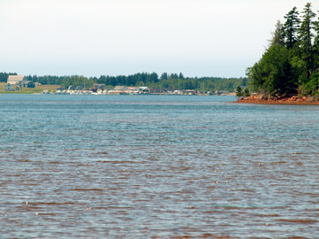
Returning back, we stopped at the Savage Harbour Slip, a busy wharf with lobster traps lined up on the slip. Due to Covid19 the wharf was not open, so I only managed to get a few shots. Retracing steps once again, we returned on Rt. #218 to where it intersected with Rt #217 and continued along that route, then turning onto Rt #350 (Creek Rd.) crossing MacInytes Creek and continuing on to a view of Savage Harbour from the other side. It made us appreciate how large the water is as we looked across to see the Slip way on the other side.
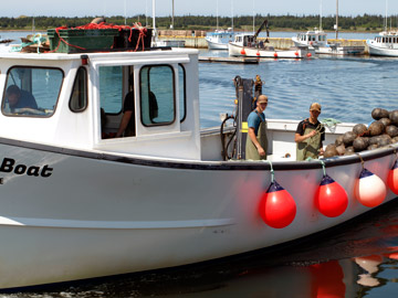 Continuing along Rt #350, we connected with Hwy#2 (St. Peter’s Rd.) At Morell, we turned toward the shore again down Red Head Rd. to Red Head Wharf. This was a busy wharf and we watched boat unloading mussels and boats leaving and arriving in the safety of the breakwater of the harbour. The lobster traps were piled high on the wharfs on both sides.
Having enjoyed our afternoon, it was time to head back, retracing our steps to Hwy#2, and continues on the intersection of Rt. #322 toward Peakes. There we drove along Rt #22 (Mt. Stewart Rd.) At Mt. Stewart we picked up Rt. #351, taking us to Hwy #2. Back onto Rt. #6, toward Millcove. At Brackley Point turn onto Rt. 15, and just before the entrance to Brackley Beach Provincial Park, turn onto Rt. 6 again to “home” to the campsite.
Click an images below to view photos of Our points east Tour of Prince Edward Island


About Karen

Karen loves to travel (in comfort) with her husband Gary and "girls" Chessey and Sadie (canines). Karen loves photography and writing so she will be sharing her experiences with you and fellow travelers and giving you a "glimpse" of what it is like to....
"Explore Atlantic Canada" and "Discover all it has to offer".
Photo Credits: Karen